Brief No. WR-7

Mecca

Project: Western Recreation   Location: Moab, UT   Subject: Moab, UT

day eight

START

Moab, UT

DISTANCE

408 mi

END

Wendover, UT

WEATHER

Low 90°s; bright blue, clouds

LODGING

Quality Inn

observations from the field

01
Days Inn Parking Lot, Moab, UT 8:49 AM

Car won't start—no problem we're at the top of a minor hill in a well-paved parking lot. Forgot to turn the keys into the "on" position, clutch therefore did not pop. Sat with my failure for a moment at the bottom of the hill. Inspired suddenly tried to start the car from scratch just in case, started right up. The woman at Love Muffin said to go to ASAP Motors on the south end of town. Dude at ASAP tested my battery, tightened a bolt (he thinks thats all it was, a loose bolt on the battery), and expressed interest in my breakfast burrito. We gave him ten dollars.

02
Slickrock Moab, UT 9:16 AM

Emiliano and Daniel on the set of Chronicles of Gnarnia Vol. III: Slickrock Shinola Showdown. Side note: Wearing gold Mardi Gold beads from the Backstreet Museum in Treme, New Orleans while riding a bike with a bell mounted to the handlebars, on singletrack, uphill, in Moab UT, may produce a ringing noise from time to time, especially on the steeper sections.

03

Slickrock Moab, UT 9:26 AM
04

Slickrock Moab, UT 9:30 AM
05
Moab, UT 10:13 AM

Weather Pontification is, it seems, a nearly universal form of human expression. Be it solicited, unsolicited, accurate, irrelevant or otherwise.

06

Moab, UT 9:30 AM
07

HWY 129, Proximal to the Colorado, UT 12:29 PM

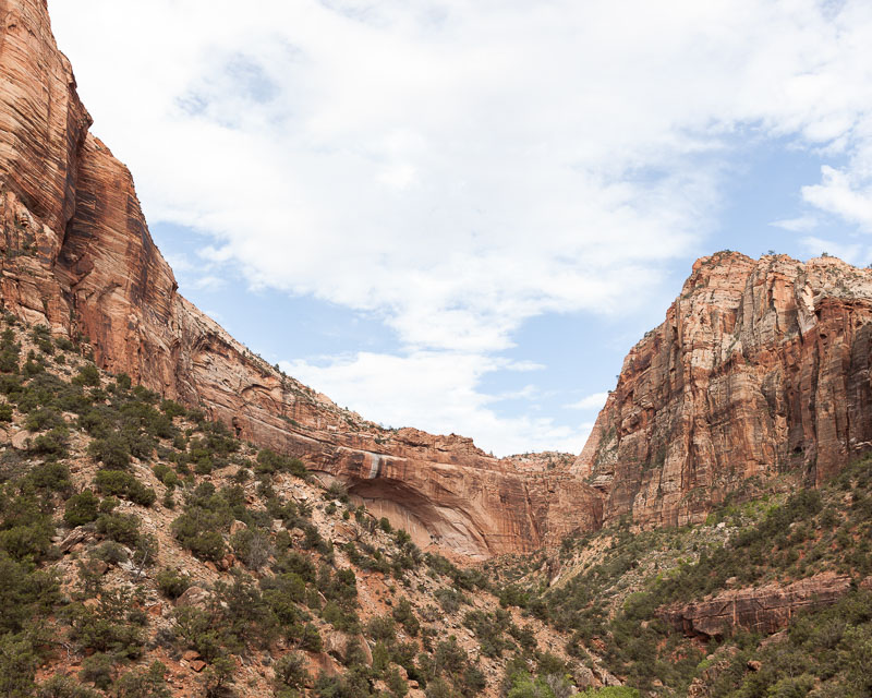
Hike Negro Bill Canyon Wilderness Survey Area on the way to Morning Glory Arches.

08
Days Inn Parking Lot Part II, Moab, UT 12:51 PM

The bathroom in the Hot Tub room of the Days Inn in Moab is clean and unlocked and can be easily accessed via the second door, or the first door after the reception office, on the north side of the building.

09
Mill Creek Swimming Hole, Moab, UT 1:54 PM

A family is worried about and talking about the algae in the river giving them a disease, like what if they became zombies says one of the older sons?

10
Mill Creek Swimming Hole, Moab, UT 2:13 PM

While frolicking in the water I notice a brand new package of those orange peanut butter crackers floating down the river over rocks and small falls, as though it was rafting.

11
Mill Creek Swimming Hole, Moab, UT 2:34 PM

A 12 year old boy jumps into small (circumferencely speaking) pot of deep water at the base of the falls below the old Power Station Dam several times.

12
Mill Creek Parking Lot, Moab, UT 2:53 PM

We pass a young man in a bucket hat, long/flowing/orange monk-style robes, sandals, sunburned shins, a modest 70's era backpack, and carrying a walking stick in one hand and a gallon jug of water in the other, several times throughout the day. The third time we see him we stop to take his portrait. His name is Thomas. He is from Portland, Oregon. He hitchhiked to Moab to visit a guy he heard about living in a cave and eating sunshine for the last 50 years. Thomas is on a spiritual quest. He doesn't know who he is or what he is anymore, he's been up for the last 30 hours. The trucker who picked him up last night gave him some cash, a slingshot and a camera. Thomas doesn't want to sleep in the cave. He is uncertain about scorpions and mountain lions, but he doesn't want to live in fear of life or death, in fact that's a large part of why he's doing what he's doing in the first place. We give Thomas a waffle and wish him well.

13
Inside My Brain, UT 3:23 PM

With nothing to do for a moment I think about the three dudes from England we met yesterday outside of Capitol Reef National Park in the parking lot of Flute Retailers. The dudes are riding road bicycles from San Francisco to New York: "Golden Gate to Empire State."

14
Green River, UT 7:30 PM

While eating (inside to avoid the bugs) at La Pasadita Outlet and Taco Cart we watched an episode of Lo Que La Vida Me Robo.

15
A Mile East of Green River, UT 7:45 PM

While driving past two cyclists on the side of the road we ask them if they need anything. They say they need food. The woman is wearing a baseball hat with God Is Good All The Time written across the front of it. They dude is wearing a yellow t-shirt. They are both wearing mostly casual clothes. They look seasoned and weathered and worn and tough. First they rode from Sacramento to Tampa on a single speed beach cruiser (his) and a Huffy Roadmaster (hers), now they're headed home. They started with no money. They're on their way to Salt Lake City to pick up their trailer and dog, which some friends took with them in a car earlier this month. He likes 120 psi and warm burritos found on the side of the road.

16
Bonneville Salt Flats, UT 12:30 AM

It's a full moon.

GEOPACKAGE COORDINATES – THIS GEOPACKAGE HAS BEEN CLAIMED

LATITUDE / LONGITUDE

38°39’7″ N 109°40’36″ W

NEAREST TOWN

Moab, UT

RELATED ROADS

Gemini Bridges Rd

GEOGRAPHICAL DESCRIPTION OF AREA

Find the rock, locate the Yonder Rhombus scratched onto the side of the rock, dig in dirt below it for Geopackage #2.

In your attempt to retrieve this Geopackage, please refer to the proper protocol regarding recovery. Of the upmost importance is to email us: [email protected] as soon as possible after finding your Geopackage.

Follow along.

#WESTERNREC ON INSTAGRAM

YONDERJOURNAL.COM – @YONDERJOURNAL

SPONSORED BY YAKIMA RACKS AND POLER STUFF

Brief No. WR-6

Recreation Hit List

Project: Western Recreation   Location: Across Utah   Subject: Tour of Utah

day seven

START

Springdale/Zion NP, UT

DISTANCE

335 mi

END

Moab, UT

WEATHER

50-80°F; rain, wind, lightning

LODGING

Day's Inn Moab

SONG OF THE DAY

Ice T - 6 in the Morning

observations from the field

01

Leaving Zion NP, UT 9:30 AM

Bryce Canyon–Grand Staircase-Escalante National Monument–Calf Creek–Capitol Reef National Park.

02
Mt. Carmel Junction, UT 9:45 AM

I purchased a fifteen dollar Navajo Nations certified Dream Catcher from the White Mountain Trading Post in Mt. Carmel, Utah near south terminus/entrance to Zion National Park.

03

Highway 24, UT 12:43 PM
04

Highway 24, UT 12:57 PM
05
Caneville, UT 2:07 PM

Swing Arm City is a massive swath of banked and rolling Bentonite Clay hills east of Capitol Reef National Park and the town of Caneville.

06
Moab, UT 5:15 PM

Zip lines are the Recreational equivalent of a canary in a mine.

GEOPACKAGE COORDINATES - THIS GEOPACKAGE HASS BEEN CLAIMED

LATITUDE / LONGITUDE

37°46'25" N 111°24'53" W

NEAREST TOWN

Kiva Koffeehouse, UT

RELATED ROADS

Highway 12

GEOGRAPHICAL DESCRIPTION OF AREA

Find the Shark Smear and QuesoFrito sign. With your back against the sign, walk 34 paces uphill in a straight line straddling the seam between chipseal and gravel. At 34 paces, turn left, away from the road and walk 14 paces toward the canyon and the edge of the hillside. At 14.5 paces, dig for Geopackage #??? (we forgot to write it down—could someone go find it and let us know?).

In your attempt to retrieve this geopackage, please refer to the proper protocol regarding recovery.

Follow along.

#WESTERNREC ON INSTAGRAM

YONDERJOURNAL.COM – @YONDERJOURNAL

SPONSORED BY YAKIMA RACKS AND POLER STUFF

Brief No. WR-5

Campground Etiquette

Project: Western Recreation   Location: Southeastern Utah   Subject: Drunk in Chacos

day six

START

Lake Powell, UT

DISTANCE

149 mi

END

Springdale/Zion NP, UT

WEATHER

87°F and partly cloudy

LODGING

South Campground Site #121

SONG OF THE DAY

Trust - Chrissy E

observations from the field

01
Lone Rock Campground, Lake Powell, UT 2:30 AMWe are parked—"With LeTent™, parking is camping."—next to Lake Powell near the end of a nearly a mile-long row of RV's and Brraaaap-related equipment like 4-wheelers, jet skis, dirt bikes, etc. We pulled in late. The massive camping/parking/launch area is dark and quiet. It's windy and raining sometimes. We build the tent and climb into it. An hour later a dude in a black Poler Napsack and Chacos walks over to our vehicle and, standing at the very bottom of our ladder, whispers up to us: "Hey, hey buddy you got a lighter?" I'm reading, he sees my headlamp and assumes I'm open for solicitations. He's nice but wobbling drunk. I tell him that I don't have a lighter and so, somewhat reluctantly, he leaves. Thirty minutes later he comes back. This time, again from the bottom of our ladder, he explains that everyone in his camp is a asleep, but since I'm awake he's curious if I wanted to help him with his boat. Apparently earlier in the day he drove it (the boat) onto a sandbar or some such shit and there is sand in the engine and he'd like my help cleaning it out whatever that means. I explain to him that in spite of my still lit headlamp I was sleeping and not really interested in manual labor. He said yeah, I guess that makes sense,.

02
Lone Rock Campground, Lake Powell, UT 9:45 AM

03
Springdale, UT 11:53 AMGeocaching or Geopackaging is, when you think about it, high-value recreational littering.

04
Angel's Landing, Zion NP, UT 2:15 PMDon't wear a Manual For SPEED SPEED SPEED shirt when hiking to the top of Angels Landing.

05
Virgin River, Zion NP, UT 3:51 PM

06
Grafton Ghost Town, UT 5:31 PMWe buried YJ Geopackage #10 in hardpacked sand at end of some single track on a low ridge next to a bush just above a dirt dead-end roundabout outside the ghost town Grafton.

07
Virgin River, Zino NP, UT 12:00 AMRAPTURE: Showering, naked, in two feet of running water in the Virgin River at Midnight under nearly a full moon.

GEOPACKAGE COORDINATES – THIS GEOPACKAGE HAS BEEN FOUND

LATITUDE / LONGITUDE

37°9'43" N 113°4'52" W

NEAREST TOWN

Grafton Ghost Town, UT

RELATED ROADS

250 S

GEOGRAPHICAL DESCRIPTION OF AREA

Find the dirt roundabout dead-end. Climb up to where Emiliano is standing. At the base of the "big bush" dig.

In your attempt to retrieve this geopackage, please refer to the proper protocol regarding recovery.

Follow along.

#WESTERNREC ON INSTAGRAM

YONDERJOURNAL.COM – @YONDERJOURNAL

SPONSORED BY YAKIMA RACKS AND POLER STUFF

Brief No. WR-4

KC Badger, Recreation Guide

Project: Western Recreation   Location: Northern Arizona   Subject: Getting Wet

day four

START

Sedona, AZ

DISTANCE

286 mi

END

Phoenix, AZ

WEATHER

106°F and sunny

LODGING

KC Badger's House

observations from the field

01
Tempe Skatepark, AZ 10:30 AM

"110 degrees is my cutoff, I won't skate if it goes over 110. I've skated in 115 but it feels like you eyes are melting out of your head."
—Shawn Gregoire

02
Salt River, AZ 1:49 PM

Rafting, Chicken Fighting, Drinking, Floating, Swimming, Barbecuing, Ray-Banging.

03
Saguaro Lake, AZ 2:18 PM

Cliff Jumping—20 feet, 30 feet, 40 feet, 50 feet, Jet Skis, Boating, Docking, Wakeboarding.

04
Military Sinkhole Scenic Overlook, AZ 4:49 PM

"I live in Tucson, Arizona, I'm out camping to stay out of the heat. I have a beautiful wife, I'm six years older than her mother. My wife had a real sad, sad, horrible upbringing before she met me, through bad alcohol abuses and religion. I told her if she would hang out with me I could get some of the sadness off her face and she did, even though she's very sick from all the traumatizing she had when she was younger. She's in California now, in Anaheim. She'll be back in three weeks. Her name is Brenda and I'm waiting for her."
—Ron Chester

05
Woods Canyon Lake, AZ 5:06 PM

Family Fishing (Redear Sunfish), Kayaking, Camping, Hiking.

06
Mogollon Rim, AZ 6:22 PM

We secured Geopackage #3 under a ledge beyond some rocks at an Unofficial Scenic Overlook.

07
Northern Arizona, All Day

Yonder Journal spent the day with KC Badger, Ex-Professional BMX Rider and Professional Fly Fisher, Shawn Gregoire, Professional Amateur Skateboarder, and Chad Osburn, Professional BMX Rider.

GEOPACKAGE COORDINATES – THIS GEOPACKAGE HAS BEEN FOUND

LATITUDE / LONGITUDE

34°19'5" N 110°56'54" W

NEAREST TOWN

Payson, AZ

RELATED ROADS

Rim Road

GEOGRAPHICAL DESCRIPTION OF AREA

Shortly after the road turns from paved to gravel there will be a turnout on your left. Park there and walk through the trees toward the Mogollon Rim. Continue past the paved path toward the small outcropping of red rocks overlooking the valley below. Jump down to the to the right of the most prominent ledge and look to your left. You should be looking at a rock with a cave art-style elk and a Yonder rhombus scratched into it. Behind that rock is YJ Geopackage #3.

In your attempt to retrieve this geopackage, please refer to the proper protocol regarding recovery.

Follow along.

#WESTERNREC ON INSTAGRAM

YONDERJOURNAL.COM – @YONDERJOURNAL

SPONSORED BY YAKIMA RACKS AND POLER STUFF

Brief No. WR-3

Energy

Project: Western Recreation   Location: Northern Arizona   Subject: Rodeos + Whole Foods

day three

START

Quartzsite, AZ

DISTANCE

349 mi

END

Sedona, AZ

WEATHER

84°F and sunny

LODGING

Undisclosed

observations from the field

01
Aguila, AZ 11:45 AM
We drive past a number of speciality RV Parks right off US 60, e.g. Desert Palms Golf and RV Park.

02
Hope, AZ 12:01 PM

After driving through the town of Hope we see a city limits-type sign on the side of the road. The sign reads: Your Now Beyond Hope. Which is funny in spite of, or possibly because of, the misspelling.

03
Prescott, AZ 1:30 PM

At the entrance to the Prescott Frontier Days Rodeo, "The World's Oldest Rodeo," we ask the parking lot attendant if there was anyone here, like, is it crowded and happening? He replies: "You see dem stands, well dem stands is already full."

04
Frontier Days Rodeo 1:40 PM

While standing in line to buy rodeo tickets we overhear the man behind us talking to a woman he had just recognized as she was leaving the grounds—"Do they have the monkey on the dog this year? That's why I come. I come to see the monkey on the dog."

05
Frontier Days Rodeo 1:55 PM

During a break in the activities the announcer asks the crowd how many of us are Democrats. He says clap if you're a Democrat. Of the 2000-plus or so people in the stands, two people, clearly sitting together, clap tentatively. Then the announcer asks how many of us are Republicans, and, predictably, the crowd erupts into area-wide clapping and shouting, some people jump to their feet.

06
Frontier Days Rodeo 2:01 PM

Young man with braces in a security vests asks, are your cameras shorter than three inches?" That's a personal question. No laugh. We say what do you mean, do you want to know if we have telephoto or zoom lens, or if the cameras shoot video. Because we think maybe that's what he needs to know. He is wearing a Time Life Operator Headset and obviously listening to someone, an eye in the sky, tell him what to ask us. He is relaying our answers word for word back to the eye in the sky. Finally we say yeah, sure our cameras are only three inches long, which cameras are in our hands and in plain sight, and which cameras are clearly over three inches in every way possible, but dude tells eye in the sky and eye in the sky is satisfied except for one last question, are we wearing backpacks. We are clearly not wearing backpacks, so we say, we are not wearing backpacks, dude tells eye in the sky we are not wearing backpacks. Dude tells us we are all good and free to continue photographing the rodeo from the media access only area. The only question the dude and eye in the sky didn't ask us is, do we have media credentials, which we don't.

07
Sedona, AZ 5:30 PM

The "New Frontier Natural Marketplace" is actually a Whole Foods. Standing in front of—blocking really—the spoons and forks and napkins and condiments kiosk are two scarf, sandal and turquoise wearing gray haired women and a dude in all white and sandals, they're talking about energy, the man is saying please please please don't allow those things that would divert your energy, to divert your energy.

08
Sedona, AZ Headed to West Sedona, AZ 6:30 PM

In the storefront window of Sacred Light Healing and Training there is a sign that reads, "Get your issues out of your tissues."

09
State Route 179, AZ 6:45 PM

A Tibetan-looking monk in brown nearly camouflage robes, sitting on the ground at the base of Bell Rock a few hundred yards up from a Scenic Overlook parking lot, eyes closed and arms at his side, stands suddenly to take a phone call.

10
Schnelby Hill Road, 7:30 PM

We bury, in the sand at the base of two Ponderosa Pines, Yonder Geopackage #6.

11
Southbound on US 17, AZ 10:30 PM

Thunderstorms over Coconino National Forest

12
Between Phoenix and Tempe on HWY 10, AZ 11:00 PM

A variable Message Sign above the highway reads: Drive Hammered, Get Nailed.

GEOPACKAGE COORDINATES – THIS GEOPACKAGE HAS BEEN FOUND

LATITUDE / LONGITUDE

34°52'6" N 111°44'7" W

NEAREST TOWN

Sedona, AZ

RELATED ROADS

Schnelby Hill Road

GEOGRAPHICAL DESCRIPTION OF AREA

Geopackage. Drive (or mountain bike) 1.3 miles up Schnebly Hill Road. On the left (north side) there will be a slight turnout. Follow the trail at the top/east end of the slight turnout down twenty or so feet to a campground area. To your right there will be a picnic table. To your left, there will be another picnic table—though this one is more difficult to see. In front of you is a dry river bed. In front of the dry river bed, at it's edge, there are two ponderosa pines, start digging.

In your attempt to retrieve this geopackage, please refer to the proper protocol regarding recovery.

Follow along.

#WESTERNREC ON INSTAGRAM

YONDERJOURNAL.COM – @YONDERJOURNAL

SPONSORED BY YAKIMA RACKS AND POLER STUFF

Brief No. WR-2

Too Hot to Recreate

Project: Western Recreation   Location: Imperial Sand Dunes   Subject: Southern California Desert

day two

START

Brawley, CA

DISTANCE

218 mi

END

Quartzsite, AZ

WEATHER

107°F and sunny

LODGING

Super 8

observations from the field

01
Brawley, 12:30 PM

Brownies Diner. Why do some burritos come with just meat, like a flour tortilla and meat and that's it? And other burritos, like most other burritos, come with lettuce, tomatoes, beans, rice, cheese, pico de gallo, etc?

02
Brawley, 1:07 PM

It's so hot we leave the car running with the air conditioning on full while photographing the town's various store's fronts and backs, and citizens.

03
Brawley, 2:55 PM

Stiff Equipment Inc. Ag Equipment & Tillage Supplies /// Steel Sales, Repair, Fabrication, Machine Shop 1321 Main Street // 760-344-4360

04
Brawley, 3:06 PM

Bouncy Castles with or without water are a thing in the neighborhoods south and north of Main Street.

05
Brawley, 3:14 PM

Mormon Elders in cheap suits and ties on oversized hybrid mountain bikes in 107 degree heat, riding around the unpaved streets near the Ag Airport.

06
North Algodones Dunes Wilderness Area, 3:57 PM

"Braaap Till You Drop," a t-shirt idea. Artists please apply!!!!!

07
Osborne Overlook, State Route 78/Ben Hulse Highway, NE of the Imperial Sand Dunes Cahuilla Ranger Station, 4:45 PM

Dunes, bona fide.

08
Imperial Sand Dunes, 4:51 PM

The dunes are completely empty, there is absolutely nobody present recreating or otherwise. It's too hot? We begin to suspect the dunes are a winter activity.

09
State Route 78, 5:34 PM

We buried YJ Geopackage 25 in the desert a few hundred yards of the road just west of Coachella Canal Road.

10
Bombay Beach on the Salton Sea, 7:59 PM

"I'm out here photographing but there are no birds because it's too hot."—Birdwatcher. It's 105 degrees, 176,000% humidity, and it smells like dead fish and man's hubris.

11
Mecca, 8:45 PM

"Mecca is the home of the Invertebrate Chillers; sleepers/nappers who sleep/nap in uneven and/or unlevel places (staircases, bleachers, gravel parking lots, trees, etc.) in such a manner it appears they don't have bones.

12
Box Canyon Road, 9:30 PM

Lighting in the distance to the north, over Joshua Tree National Park. In a turn out halfway up the canyon, a pickup truck and some kids shooting bottle rockets at each other.

13
Denny's, Blythe, CA, 9:30 PM

"Pickles are too much, they're too aggressive. Pickles are the kind of guys that come to your party and talks too loud and then does some whack-ass break dance moves in your living room, knocking over tables and wine and shit, then takes your sister home."

GEOPACKAGE COORDINATES — THIS GEOPACKAGE HAS BEEN FOUND

LATITUDE / LONGITUDE

32°58’16″ N 115°14’35″ W

NEAREST TOWN

Brawley, CA

RELATED ROADS

State Route 78 / Ben Hulse Highway

GEOGRAPHICAL DESCRIPTION OF AREA

Turn off the road (if headed west look for a homemade sign that reads LISA), on the north side, drive roughly 100 yards to the Limited Use Area sign and park. Walk to the sign, stand to the left of the sign facing the mountains, turn to your left (west), walk in the direction of a bush roughly thirty feet away, walk around the bush and continue to the base of a low (three feet or so) mound. Dig, it's buried in the sand. With a bottle of San Pellegrino.

In your attempt to retrieve this geopackage, please refer to the proper protocol regarding recovery.

Follow along.

#WESTERNREC ON INSTAGRAM

YONDERJOURNAL.COM – @YONDERJOURNAL

SPONSORED BY YAKIMA RACKS AND POLER STUFF

Brief No. WR-1

The Fourth

Project: Western Recreation   Location: Venice Beach, CA   Subject: Independence Day

day one

START

Venice Beach, CA

DISTANCE

240 mi

END

Brawley, CA

WEATHER

82°F and sunny

CAMPGROUND

Brawley Inn

The 4th of July

By Kyle von Hoetzendorff

Everyone has a holiday. A narcissist loves their birthday, consumers pine for Christmas, the glutton awaits Thanksgiving in a ravenous fit with fork in hand—allow me to paint in broad strokes—drinkers thirst for St. Patricks day and spew their green bile over the slick wet streets, and the lovers, those willfully impassioned, they covet their adoration due on Valentines day. The macabre, the ghastly, twisted, and lost fixate with deadly intent on Halloween’s fearsome delight. And if we approach my anointed annual day of idolatry with the same blunt pen then it would only be fair to characterize the Fourth of July as the holiday of the national zealot, the blind jingoist, the patronizing patriot. With its red,white, and blue, its explosive odes to warfare, and its insistent smell of charcoal and sunscreen, The Fourth as it is so lovingly referred is my holiday.

As a reluctant patriot there are things about The Fourth that I can’t help but admire in spite of its fatuous nationalism.

  1. It happens in the middle of the summer. I am a product of California, long transplanted to Oregon. I am a vitamin D addict that has been in rehab for the past decade and The Fourth's position at the apogee of light and heat means that I will spend the day flush with the stuff like a zooted-out phototropic Burroughs in a full spectrum Tangiers.
  2. No gifts required. Unlike so many of the other top-rated national holidays celebrating The Fourth doesn’t require much in the way of considered forethought. Our nation already has the only gift it ever needs, and that gift is you. Skip the stressful moments in the morning, the awful day-of realization that you have once again failed to source something meaningful for someone that means something to you from the world's greatest bazaar. The pressure to purchase is nonexistent on this lovely day.
  3. The pageantry of explosive waste. Fireworks are amazing, even today; in a world that is inundated with a deluge of sensory information, a world where one might think that the appeal and grandeur of these explosive sky flowers would have faded into hyper-culture’s Technicolor digital atmosphere, their concussive magnitude continues to captivate. Mouth agape and eyes wide, young and old stare skyward in the thrall of the dazzling pantomime of incendiary atomic choreography.
  4. An open-ended invitation for involvement. The top-tier holidays enjoy a familial or collegial closed participation system, an invite-based selection system or some prescribed cultural vestige—a green shirt, a costume, some pumpkin pie, a present, or chocolate eggs. The Fourth doesn’t require anything but a willingness to participate, to see where the day's experience will take you, to allow the swell of cultural energy to carry you headlong into an unknown future filled with chances and risk.

It is this final aspect, the 4th of The Fourth that exposes what’s at the heart of my 4J infatuation. This hot dog, hot tub, squirt gun, tank top, catsup, mustard, relish, and barbeque infused holiday isn’t about celebrating our national history as much as it is about celebrating the motivation that created this unique land of ours. Ours is a land of outcasts and folks on the fringe, cultural refugees and civic refuse. We are the people that wouldn’t take shit, “Why don’t you take your religious persecution and shove it.” We are the cultural descendents of a contrary unflinching bunch of hardnosed assholes. Before we became high on the hog and fat with self-indulgence, before we became the bully we were the bullied. We were the little brother that would do it, whatever it is, just to shove it the face of his older brother and his friends. America is a lot about fuck you. Tell us we can’t do it, we dare you. We are inherently contrary and while it could be easily argued that the country has lost much of its antagonistic edge there remains woven into our cultural core an atavistic urge to push buttons, cross boundaries, and explore limits. This is the attitude that, right or wrong, settled the West, landed on the Moon and invented the Internet, that pushed through the impassable and settled the inhospitable. We race what shouldn’t be raced; celebrate the trite and the trivial as well as the grand and eloquent.

It is with this idea in mind that we set out to explore the American West, its peoples and their cultures. We hope to find the threads of our cultural heritage and tease them out, to prove that all is not lost, rather that it has always been there hiding in plain site and only requiring some one to really look at it. And that’s what we hope to do. We plan to really look.

observations from the field

01
Venice Beach, 1:30 PM

Mr and Ms Muscle Competition.

02
Culver City, 4:30 PM

Versailles, 2 half chickens and 2 Cokes.

03
Atwater Village, 7:30 PM

Buried Geopackage #11 near the Los Angeles River, several permanent or semi-permanent encampments on the islands in the middle of the river, old men fishing under Fletcher Street Bridge. The Los Angeles River was recently opened to recreation, i.e. kayaking. From the bottom of the viaduct wall we hear and glimpse several people swimming on the far side of an island.

04
Highland Park to Pasadena, 10:00 PM

On every street in a ten mile radius of the Rose Bowl, everywhere and anywhere with a modicum of vantage—bridges, corners, stairwells, turnouts, etc—people are camped and crowded together to watch the fireworks.

05
Hwy 210, eastbound, 75MPH, 10:30 PM

Firework displays in every direction; over Arcata, Azusa, San Dimas, Claremont, Rancho Cucamonga, etc.

06
Salton Sea City, 1:30 AM

94°F.

GEOPACKAGE COORDINATES — THIS GEOPACKAGE HAS BEEN FOUND

LATITUDE / LONGITUDE

34°6'29" N 118°15'26" W

NEAREST TOWN

Atwater Village, LA

RELATED ROADS

Crystal Street

GEOGRAPHICAL DESCRIPTION OF AREA

Near the Fletcher Street Bridge take the Crystal Street entrance to the Los Angeles River Greenway Trail. At the bottom of the entrance ramp continue straight (or left) in the northwest direction. In a few hundred yards you will see a drainage pipe (link to photo) on your left. Just above and to the left of the drainage pipe at the base of tree (link to photo), YJ Geopackage #11.

In your attempt to retreieve this geocache, please refer to the proper protocol regarding the recovery of the American Field Studies: Western Recreation geocaches.

Follow along.

#WESTERNREC ON INSTAGRAM

YONDERJOURNAL.COM – @YONDERJOURNAL

SPONSORED BY YAKIMA RACKS AND POLER STUFF

Page 2 of 212