day six
START
Lake Powell, UT
DISTANCE
149 mi
END
Springdale/Zion NP, UT
observations from the field
01
Lone Rock Campground, Lake Powell, UT 2:30 AMWe are parked—"With LeTent™, parking is camping."—next to Lake Powell near the end of a nearly a mile-long row of RV's and Brraaaap-related equipment like 4-wheelers, jet skis, dirt bikes, etc. We pulled in late. The massive camping/parking/launch area is dark and quiet. It's windy and raining sometimes. We build the tent and climb into it. An hour later a dude in a black Poler Napsack and Chacos walks over to our vehicle and, standing at the very bottom of our ladder, whispers up to us: "Hey, hey buddy you got a lighter?" I'm reading, he sees my headlamp and assumes I'm open for solicitations. He's nice but wobbling drunk. I tell him that I don't have a lighter and so, somewhat reluctantly, he leaves. Thirty minutes later he comes back. This time, again from the bottom of our ladder, he explains that everyone in his camp is a asleep, but since I'm awake he's curious if I wanted to help him with his boat. Apparently earlier in the day he drove it (the boat) onto a sandbar or some such shit and there is sand in the engine and he'd like my help cleaning it out whatever that means. I explain to him that in spite of my still lit headlamp I was sleeping and not really interested in manual labor. He said yeah, I guess that makes sense,.
Lone Rock Campground, Lake Powell, UT 2:30 AMWe are parked—"With LeTent™, parking is camping."—next to Lake Powell near the end of a nearly a mile-long row of RV's and Brraaaap-related equipment like 4-wheelers, jet skis, dirt bikes, etc. We pulled in late. The massive camping/parking/launch area is dark and quiet. It's windy and raining sometimes. We build the tent and climb into it. An hour later a dude in a black Poler Napsack and Chacos walks over to our vehicle and, standing at the very bottom of our ladder, whispers up to us: "Hey, hey buddy you got a lighter?" I'm reading, he sees my headlamp and assumes I'm open for solicitations. He's nice but wobbling drunk. I tell him that I don't have a lighter and so, somewhat reluctantly, he leaves. Thirty minutes later he comes back. This time, again from the bottom of our ladder, he explains that everyone in his camp is a asleep, but since I'm awake he's curious if I wanted to help him with his boat. Apparently earlier in the day he drove it (the boat) onto a sandbar or some such shit and there is sand in the engine and he'd like my help cleaning it out whatever that means. I explain to him that in spite of my still lit headlamp I was sleeping and not really interested in manual labor. He said yeah, I guess that makes sense,.
02
Lone Rock Campground, Lake Powell, UT 9:45 AM
Lone Rock Campground, Lake Powell, UT 9:45 AM
03
Springdale, UT 11:53 AMGeocaching or Geopackaging is, when you think about it, high-value recreational littering.
Springdale, UT 11:53 AMGeocaching or Geopackaging is, when you think about it, high-value recreational littering.
04
Angel's Landing, Zion NP, UT 2:15 PMDon't wear a Manual For SPEED SPEED SPEED shirt when hiking to the top of Angels Landing.
Angel's Landing, Zion NP, UT 2:15 PMDon't wear a Manual For SPEED SPEED SPEED shirt when hiking to the top of Angels Landing.
05
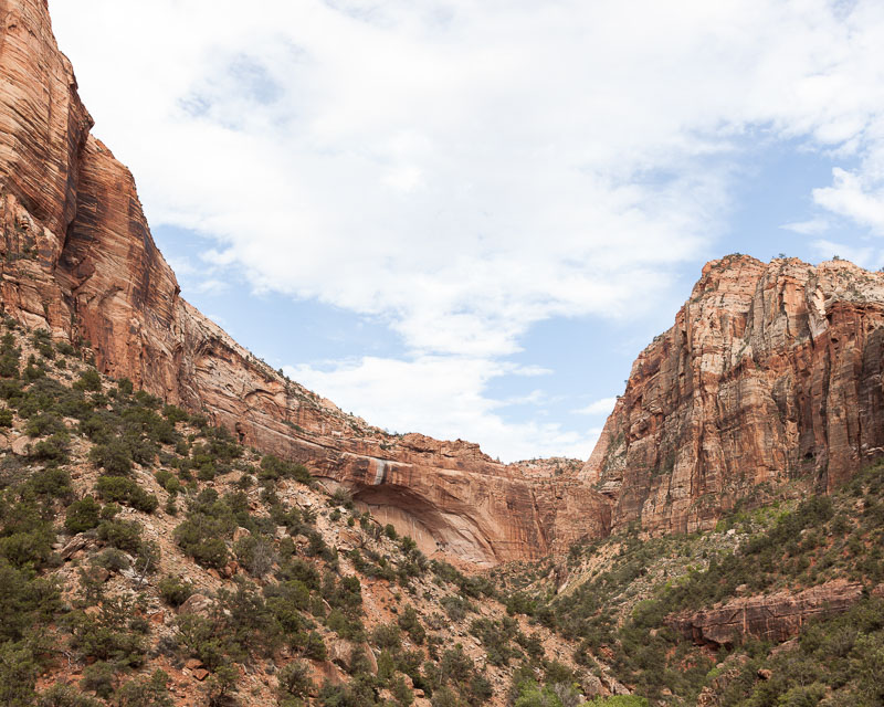
Virgin River, Zion NP, UT 3:51 PM
Virgin River, Zion NP, UT 3:51 PM
06
Grafton Ghost Town, UT 5:31 PMWe buried YJ Geopackage #10 in hardpacked sand at end of some single track on a low ridge next to a bush just above a dirt dead-end roundabout outside the ghost town Grafton.
Grafton Ghost Town, UT 5:31 PMWe buried YJ Geopackage #10 in hardpacked sand at end of some single track on a low ridge next to a bush just above a dirt dead-end roundabout outside the ghost town Grafton.
07
Virgin River, Zino NP, UT 12:00 AMRAPTURE: Showering, naked, in two feet of running water in the Virgin River at Midnight under nearly a full moon.
Virgin River, Zino NP, UT 12:00 AMRAPTURE: Showering, naked, in two feet of running water in the Virgin River at Midnight under nearly a full moon.
GEOCACHE COORDINATES
LATITUDE / LONGITUDE
37°9'43" N 113°4'52" W
NEAREST TOWN
Grafton Ghost Town, UT
RELATED ROADS
250 S
GEOGRAPHICAL DESCRIPTION OF AREA
Find the dirt roundabout dead-end. Climb up to where Emiliano is standing. At the base of the "big bush" dig.
In your attempt to retrieve this geopackage, please refer to the proper protocol regarding recovery.
Follow along.
#WESTERNREC ON INSTAGRAM
YONDERJOURNAL.COM – @YONDERJOURNAL
SPONSORED BY YAKIMA RACKS AND POLER STUFF